Long before humans thought of putting satellites in space and use them for GPS tracking, there’s this device called the Iter Avto which aid drivers to navigate their way around the block.
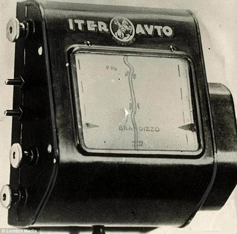
Invented in the 1930’s, the Iter Avto comes with a set of paper maps that were rolled inside its fairly large body. It is then connected to the car’s speedometer which basically dictates the pace in which the Iter Avto scrolls the maps to show the approximate location of the driver.
Unfortunately, despite of its bulky frame, the Iter Avto can only accommodate a certain number of maps. This means that when a driver needs to veer away from the road that’s currently being display, he/she needs to swap the map with the appropriate one and determine where they are on the map in order to proceed.
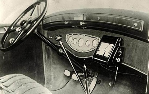
Apart from what was mentioned above, little is known about the origins of the Iter Avto, who invented it and which cars were equipped with it. This is probably because the device didn’t really take off because cars, in general, were still too costly for most people back then.


I used to be suggested this blog by way of my
cousin. I am no longer positive whether or not this submit is written through him
as nobody else recognize such exact about my trouble. You’re
amazing! Thank you!